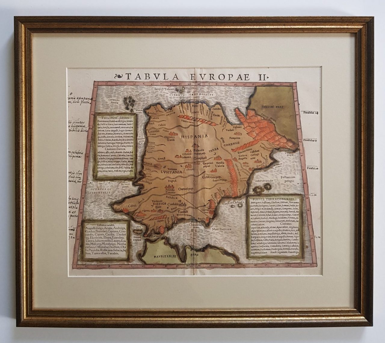
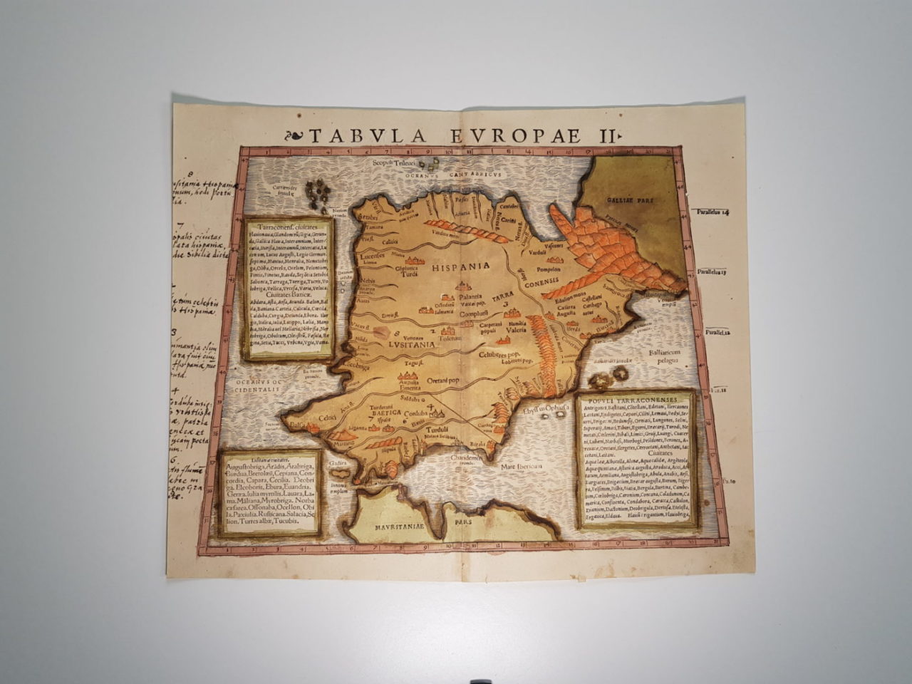
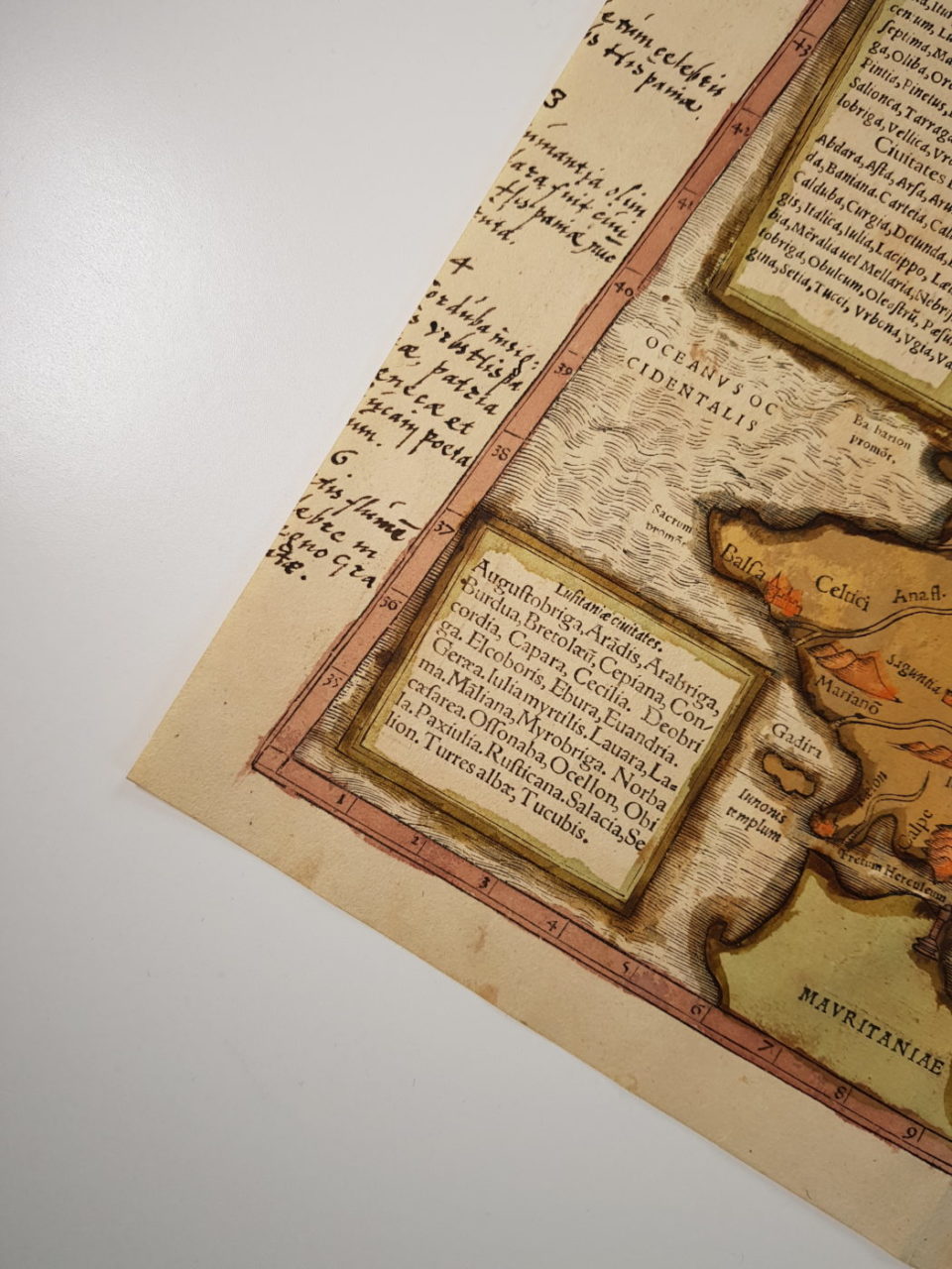
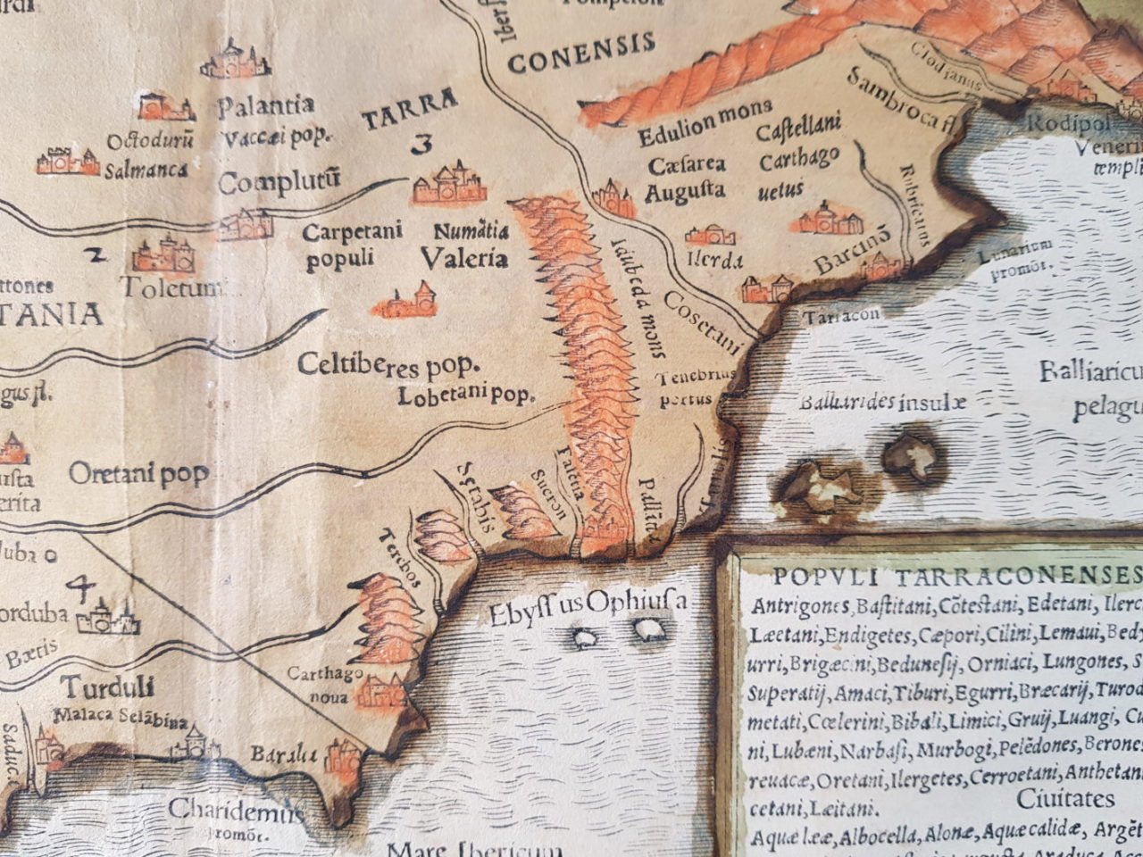
An extremely rare old hand coloured example of Munster’s map of Spain and Portugal from the 1540 edition of Geographia. Acid free mount , modern gilt frame.
Details
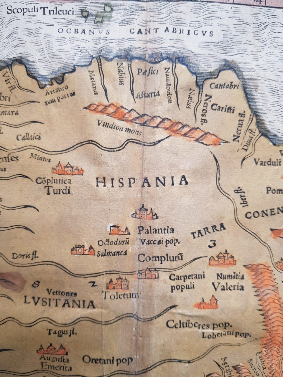
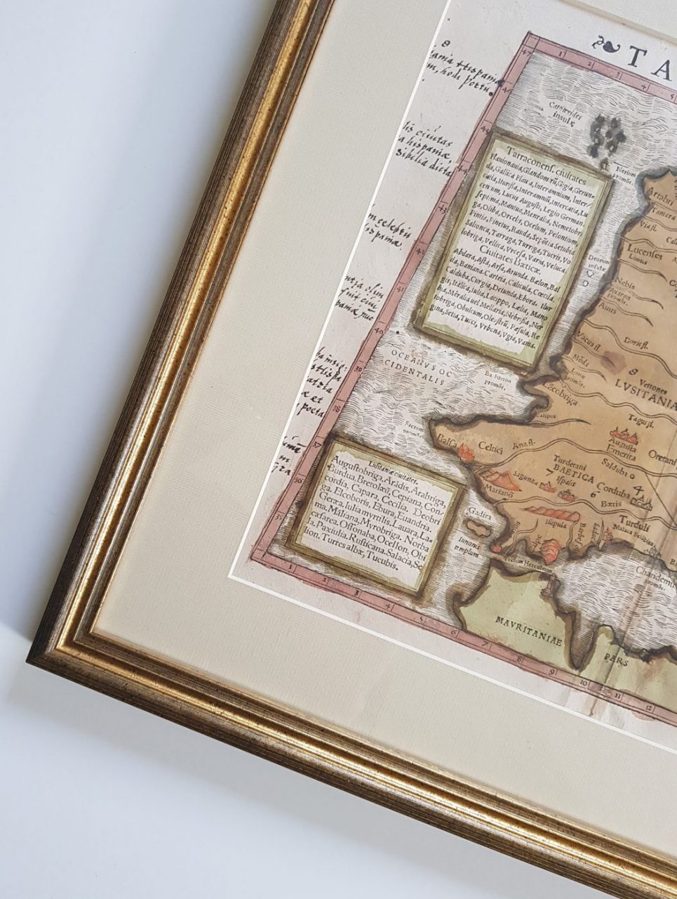
Excellent old hand coloured example of Munster’s map of Spain & Portugal from the 1540 edition of Munster’s Geographia. The map shows a fabulous depiction of the region as it was known in Ptolemy’s time. This is the first edition, first state of Munster’s map which is distinguished by the printer’s device to the left of the title and the triangle to the right. Munster’s Geographia (first issued in 1540 ) and Cosmographia (1548) are the most important and widely copied geographical works of the mid-16th century and, for most Europeans, it represented the first accessible imagery (maps and views) of the World. Few of the charts and maps by the first Spanish navigators have survived as the pilots had to give their manuscripts over to the Casa de Contratacion de las Indias in Seville who wanted to keep new discoveries secret. However some material must have been concealed and sent to other sources in Italy and the cartographers of Venice, Genoa and Florence.
Condition: 16th century hand colour. Early ink marginalia, tight to the left margin and minor wormholes.
Please note: Price does NOT include delivery costs.